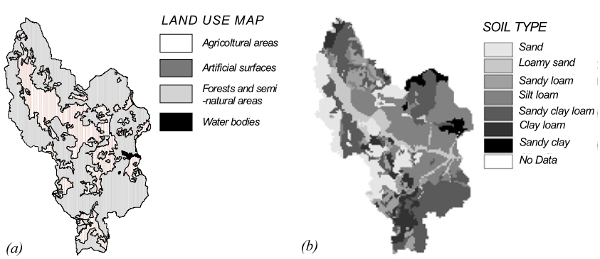
The spatial distribution of soil properties is directly involved in the fluctuation of soil moisture conditions and in the runoff generation mechanisms. In this work, the influences of the physical characteristics of the contributing area to the peak flow were widely investigated with the aim of understanding the influences of each physical parameter. The study was conducted by means of a hydrological distributed model (Manfreda et al. [7]), applied on the study area of the Agri river basin at Tarangelo (507 km2), in the region of Basilicata, Italy. Two different time scales were used: the first with higher temporal resolution (1-hour) dedicated to the superficial routing, the latter at daily scale used for local water balances and subsurface flow evaluation. Using the model at daily scale, daily soil moisture maps and the river discharge at the outlet are obtained. These results were used as input for the model at the hourly scale in order to describe the initial conditions in the watershed for event simulations. The simulation was carried on by using a synthetic hourly rainfall series generated by using the IRP model proposed by Veneziano & Iacobellis [9]. By using the rainfall-runoff model it was possible to simulate a large number of extreme events and consequently evaluate the relative contributing area to the peak flow. Specifically, every cell of these areas was classified for its vegetational, pedological and morphological characteristics with the aim of interpreting the relationship between physical properties and potential contribute to flow peaks.
How to cite: Manfreda, S., D. Carriero, V. Iacobellis, A. Sole & M. Fiorentino, The Effects of Soil Properties on Floods in the Agri Basin (Southern Italy), River Basin Management II (edited by C.A. Brebbia), WITpress, pp. 321-330, (ISBN 1-85312-966-6), 2003.