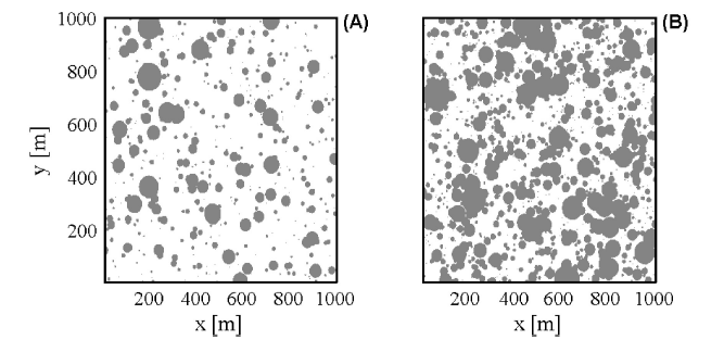
The present paper complements that of Isham et al. (2005), who introduced a space-time soil moisture model driven by stochastic space-time rainfall forcing with homogeneous vegetation and in the absence of topographical landscape effects. However, the spatial variability of vegetation may significantly modify the soil moisture dynamics with important implications for hydrological modeling. In the present paper, vegetation heterogeneity is incorporated through a two dimensional Poisson process representing the coexistence of two functionally different types of plants (e.g., trees and grasses). The space-time statistical structure of relative soil moisture is characterized through its covariance function which depends on soil, vegetation, and rainfall patterns. The statistical properties of the soil moisture process averaged in space and time are also investigated. These properties are especially important for any modeling that aggregates soil moisture characteristics over a range of spatial and temporal scales. It is found that particularly at small scales, vegetation heterogeneity has a significant impact on the averaged process as compared with the uniform vegetation case. Also, averaging in space considerably smoothes the soil moisture process, but in contrast, averaging in time up to 1 week leads to little change in the variance of the averaged process.
How to cite: Rodríguez-Iturbe, I., V. Isham, D.R. Cox, S. Manfreda, A. Porporato, Space-time modeling of soil moisture: stochastic rainfall forcing with heterogeneous vegetation, Water Resources Research, 42, W06D05, (doi:10.1029/2005WR004497), 2006. [pdf]
