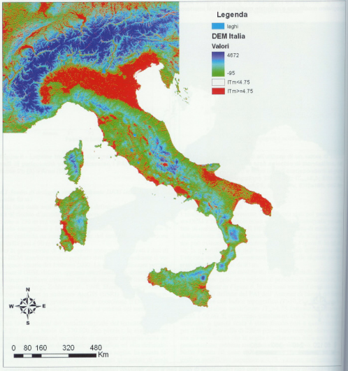
The objetive of the present research was the evaluation of the flood exposure of the Italian territory. For this reason, the national territory has been subdivided in national, interregional and regional catchments according to the actual legislation regarding the soil defence (Law 183 of 1989). Such approach has been used in order to organize, within a Geographical Information System, the existing cartographic and technical documentation on flood exposure and risk produced by the local Agencies recently instituted. Using this documentation, we obtained a partical coverage of the Italian territory that has been extremely useful to explore new methods to define areas where the flood exposure is relatively high. A new method is presented for the definition of the areas exposed to floods that is based on the geomorphological characteristics of the territory. In particular, it was found that the flooding areas can be delineated fairly well trough a modified topographic index ITm = ln(an / tan(b)), where a is the drainage area per unit contour length, tan (b) is the local slope in the steepest descent direction and n is an exponent that was found to be close to 0.15-0.20. Such analyses have been carried out using a digital elevation model at 230 m and one at 90 m of resolution produced by NASA.
How to cite: Manfreda, S., A. Sole, e M. Fiorentino, Valutazione del pericolo di allagamento sul territorio nazionale mediante un approccio di tipo geomorfologico, L’Acqua, N.4, 43-54, 2007. [pdf]