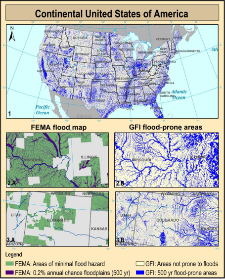
Knowing the location and the extent of the areas exposed to flood hazards is essential to any strategy for minimizing the risk. Unfortunately, in ungauged basins the use of traditional floodplain mapping techniques is prevented by the lack of the extensive data required. The present work aims to overcome this limitation by defining an alternative simplified procedure for a preliminary floodplain delineation based on the use of geomorphic classifiers. To validate the method in a data-rich environment, eleven flood-related morphological descriptors derived from remotely sensed elevation data have been used as linear binary classifiers over the Ohio River basin and its sub-catchments. Their performances have been measured at the change of the topography and the size of the calibration area, allowing to explore the transferability of the calibrated parameters, and to define the minimum extent of the calibration area. The best performing classifiers among those analysed have been applied and validated across the continental U.S. The results suggest that the classifier based on the Geomorphic Flood Index (GFI), is the most suitable to detect the flood-prone areas in data-scarce regions and for large-scale applications, providing good accuracies with low requirements in terms of data and computational costs. This index is defined as the logarithm of the ratio between the water depth in the element of the river network closest to the point under exam (estimated using a hydraulic scaling function based on contributing area) and the elevation difference between these two points.
How to cite: Caterina Samela, Tara J. Troy, Salvatore Manfreda, Geomorphic classifiers for flood-prone areas delineation for data-scarce environments, Advances in Water Resources (doi: 10.1016/ j.advwatres.2017.01.007) 2017. [pdf]