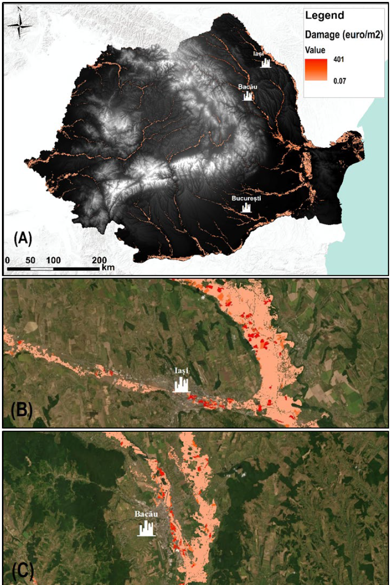
Large-scale flood risk assessment is essential in supporting national and global policies, emergency operations and land-use management. The present study proposes a cost-efficient method for the large-scale mapping of direct economic flood damage in data-scarce environments. The proposed framework consists of three main stages: (i) deriving a water depth map through a geomorphic method based on a supervised linear binary classification; (ii) generating an exposure land-use map developed from multi-spectral Landsat 8 satellite images using a machine-learning classification algorithm; and (iii) performing a flood damage assessment using a GIS tool, based on the vulnerability (depth–damage) curves method. The proposed integrated method was applied over the entire country of Romania (including minor order basins) for a 100-year return time at 30-m resolution. The results showed how the description of flood risk may especially benefit from the ability of the proposed cost-efficient model to carry out large-scale analyses in data-scarce environments. This approach may help in performing and updating risk assessments and management, taking into account the temporal and spatial changes in hazard, exposure, and vulnerability.
How to cite: Albano, R.; Samela, C.; Crăciun, I.; Manfreda, S.; Adamowski, J.; Sole, A.; Sivertun, Å.; Ozunu, A. Large Scale Flood Risk Mapping in Data Scarce Environments: An Application for Romania. Water 2020, 12, 1834.
