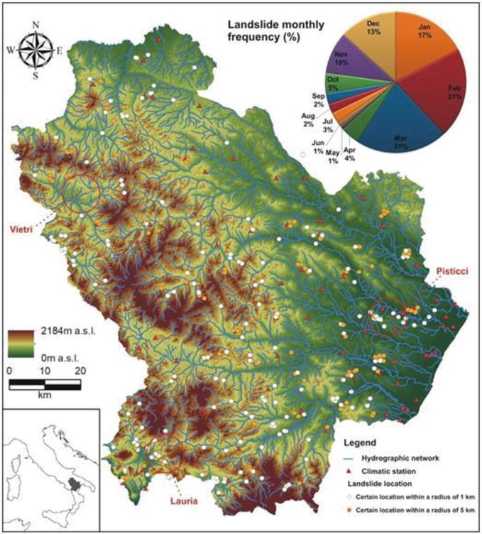
Rainfall-triggered shallow landslide events have caused losses of human lives and millions of euros in damage to property in all parts of the world. The need to prevent such hazards combined with the difficulty of describing the geomorphological processes over regional scales led to the adoption of empirical rainfall thresholds derived from records of rainfall events triggering landslides. These rainfall intensity thresholds are generally computed, assuming that all events are not influenced by antecedent soil moisture conditions. Nevertheless, it is expected that antecedent soil moisture conditions may provide critical support for the correct definition of the triggering conditions. Therefore, we explored the role of antecedent soil moisture on critical rainfall intensity-duration thresholds to evaluate the possibility of modifying or improving traditional approaches. The study was carried out using 326 landslide events that occurred in the last 18 years in the Basilicata region (southern Italy). Besides the ordinary data (i.e., rainstorm intensity and duration), we also derived the antecedent soil moisture conditions using a parsimonious hydrological model. These data have been used to derive the rainfall intensity thresholds conditional on the antecedent saturation of soil quantifying the impact of such parameters on rainfall thresholds.
How to cite: Lazzari, M., M. Piccarreta, R. L. Ray and S. Manfreda, Modelling antecedent soil moisture to constrain rainfall thresholds for shallow landslides occurrence, Landslides edited by Dr. Ram Ray, IntechOpen, pp. 1-331, (10.5772/intechopen.92730) 2020. [Link]
