Use of Drones for Environmental Monitoring
The book “Unmanned Aerial Systems for Monitoring Soil, Vegetation, and Riverine Environments” is the result of five years of intense activities carried out within the context of the COST Action…
Università degli Studi di Napoli Federico II - DICEA
The book “Unmanned Aerial Systems for Monitoring Soil, Vegetation, and Riverine Environments” is the result of five years of intense activities carried out within the context of the COST Action…
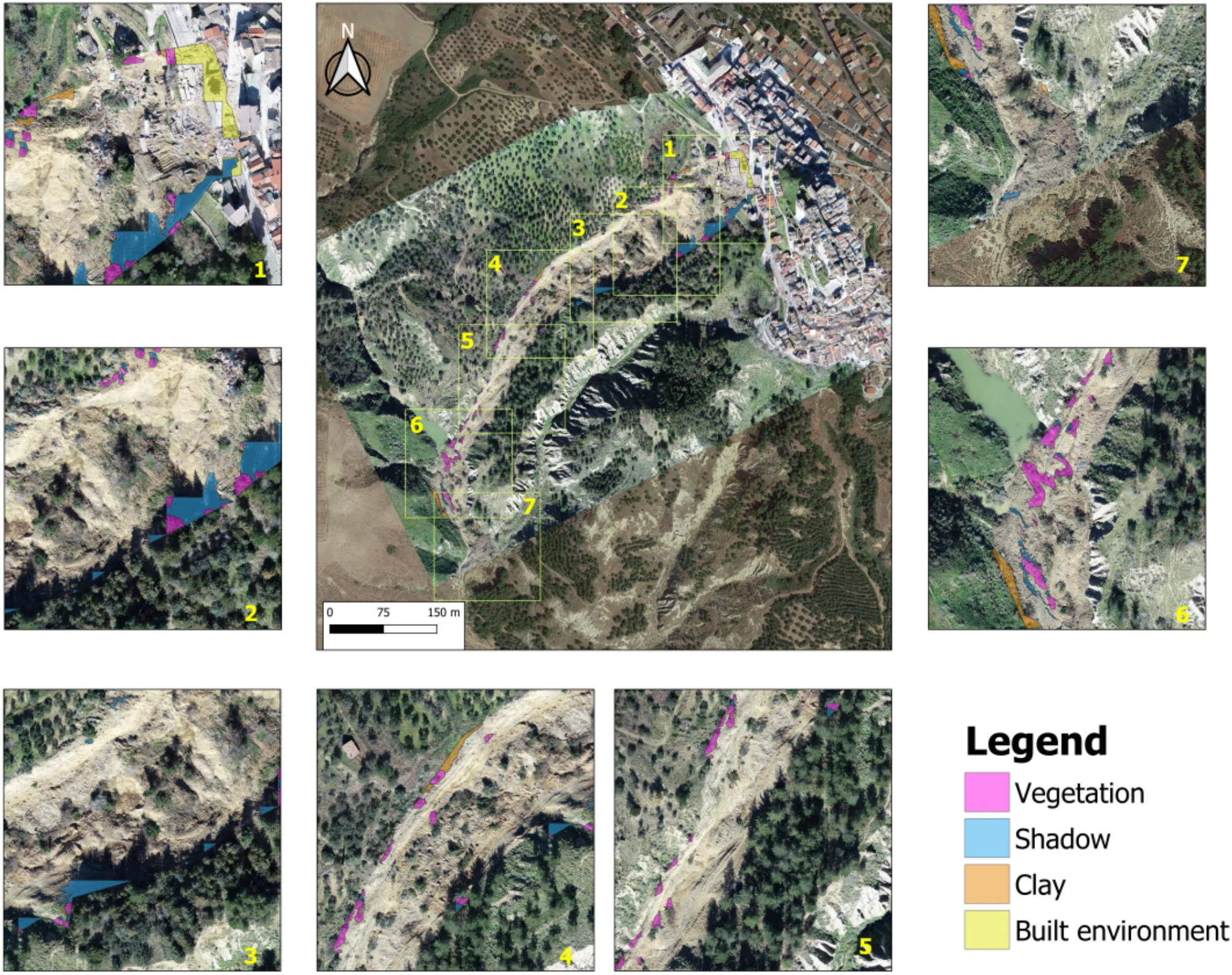
In the last decades, the availability of multi-source, multi-scale, and multi-resolution remote sensing data and the consequent progress of processing techniques brought a significant positive impact for landslide detection. As…