
SMAR: Soil moisture analytical relationship
Code for the application of the SMAR model (Manfreda et al., 2014) and its calibration when root-zone soil moisture data are available for parameter calibration. Available on Zenodo References Manfreda,…
Università degli Studi di Napoli Federico II - DICEA
Code for the application of the SMAR model (Manfreda et al., 2014) and its calibration when root-zone soil moisture data are available for parameter calibration. Available on Zenodo References Manfreda,…
The study centered on the comprehensive assessment of satellite-based microwave soil moisture (SM) products across Europe, taking into account crucial variables including geographical diversity, climate dynamics, and land cover variations.…
This chapter presents a general outlook of innovative monitoring of rivers. Special attention is given to river flow monitoring through remote sensing images. Because of the relatively low costs and…
Seven of the accomplished authors who have made significant contributions to our latest Book on Unmanned Aerial Systems (https://lnkd.in/d67imFHS) have achieved a remarkable milestone in 2023 by being recognized as…
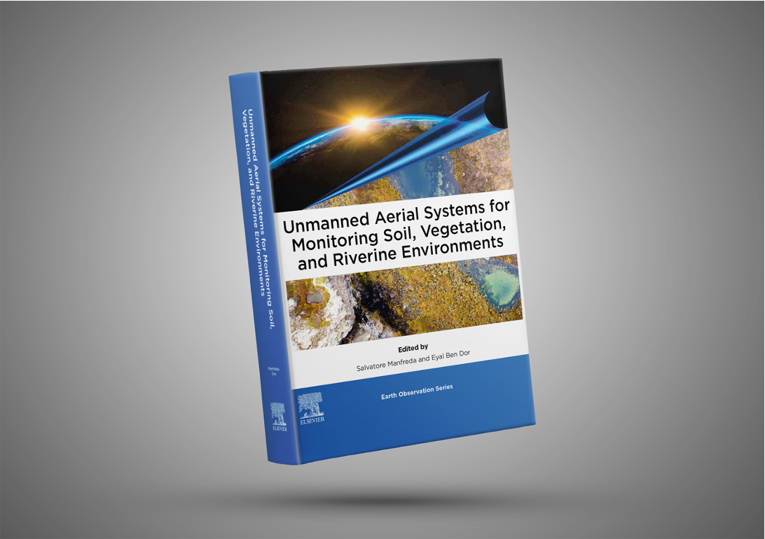
The book, “Unmanned Aerial Systems for Monitoring Soil, Vegetation, and Riverine Environment”, provides a comprehensive exploration of the applications, technologies, and methodologies related to the use of unmanned aerial systems…
If you look for a stimulating research environment in the field of hydrology, don’t miss the chance to apply for a Ph.D. scholarship at University of Naples Federico II. We…
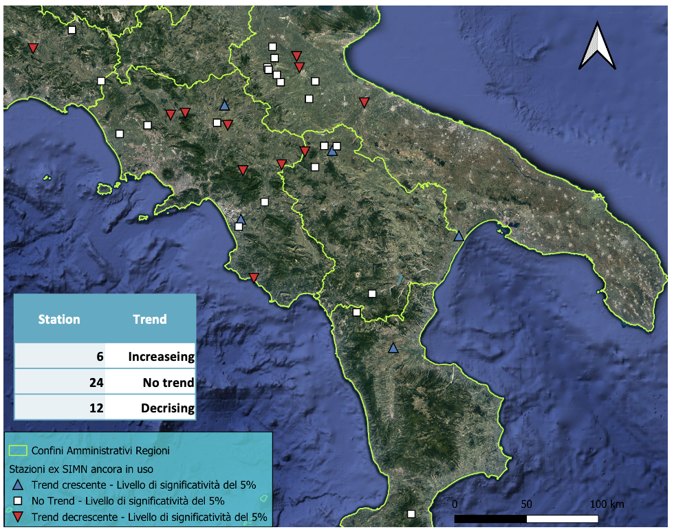
In recent years, numerous studies have shown a growing concern about the effects of climate change on the hydrological cycle and hydrological extremes. In particular, statistical analyses on either long…
The world is facing a water crisis, with rising demand, diminishing resources, and the impacts of climate change exacerbating the situation. On World Water Day 2023, we are bringing together…
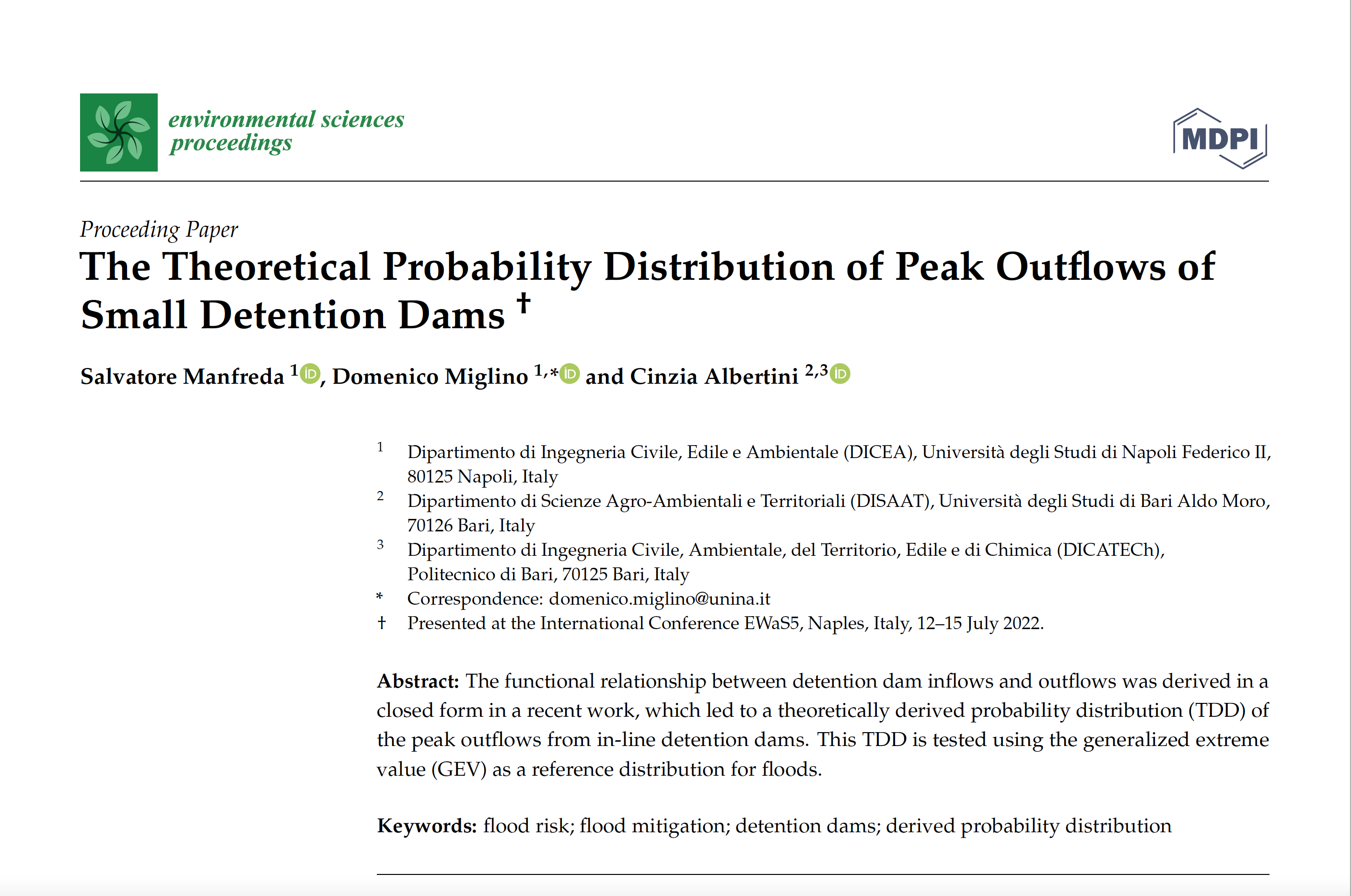
The functional relationship between detention dam inflows and outflows was derived in a closed form in a recent work, which led to a theoretically derived probability distribution (TDD) of the…
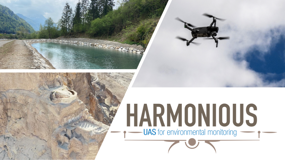
This set of three documents represents a blueprint of an Operations Manual for UAS operations (OM) targeting environmental studies, accompanied by an Emergency Response Plan (ERP) and an example of…
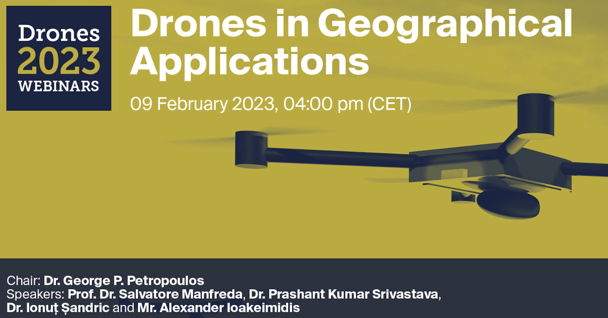
Do not miss the Webinar organised by Drones MDPI on Drones in Geographical Applications!!! Webinar will be coordinated by George P. Petropoulos and it will include the following talks: Unmanned…

Dear Friend and Colleagues, Recent years have been filled with numerous and intense collaborations and relevant achievements. As we come to the end of the year, we wanted to take…
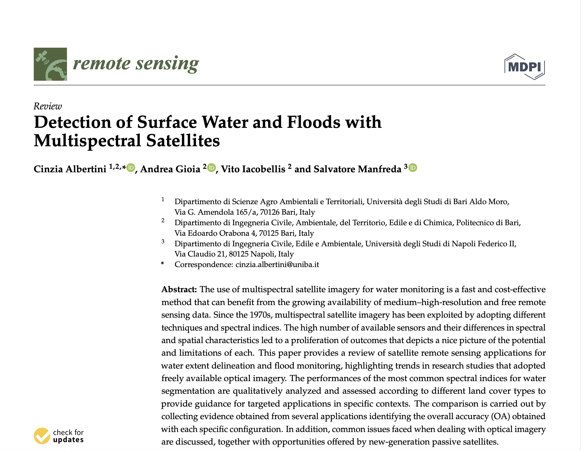
The use of multispectral satellite imagery for water monitoring is a fast and cost-effective method that can benefit from the growing availability of medium–high-resolution and free remote sensing data. Since…

Dear Colleagues, Soil Moisture (SM) is a vital element in the hydrological cycle and land–atmosphere interactions. Quantification of SM and its spatiotemporal variability is valuable for understanding water availability in…
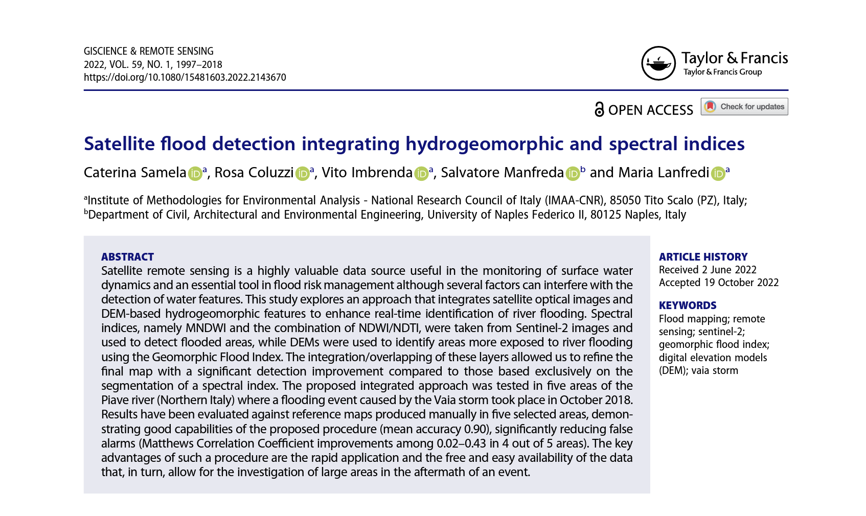
Satellite remote sensing is a highly valuable data source useful in the monitoring of surface water dynamics and an essential tool in flood risk management although several factors can interfere…