Trend of Annual Maximum Rainfall in Campania Region (Southern Italy)
Extreme rainfall events are increasing in both number and intensity at global scale; however, it is hard to quantify the impact of climate change at local scale given the strong…
Università degli Studi di Napoli Federico II - DICEA
Extreme rainfall events are increasing in both number and intensity at global scale; however, it is hard to quantify the impact of climate change at local scale given the strong…
The inherent biases of different long-term gridded surface soil moisture (SSM) products, unconstrained by the in situ observations, implies different spatio-temporal patterns. In this study, the Random Forest (RF) model…
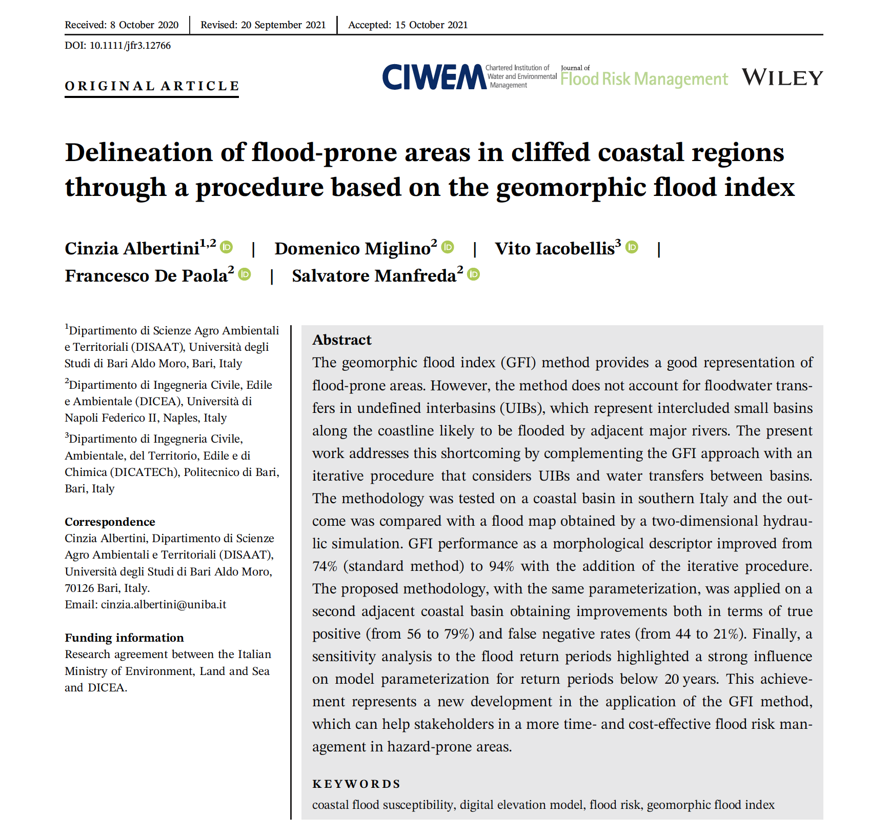
The geomorphic flood index (GFI) method provides a good representation of flood-prone areas. However, the method does not account for floodwater transfers in undefined interbasins (UIBs), which represent intercluded small…
While the availability and affordability of unmanned aerial systems (UASs) has led to the rapid development of remote sensing applications in hydrology and hydrometry, uncertainties related to such measurements must…
Ecosystem complexity is among the important drivers of biodiversity and ecosystem functioning, and unmanned aerial systems (UASs) are becoming an important tool for characterizing vegetation patterns and processes. The variety…
Videos acquired from Unmanned Aerial Systems (UAS) allow for monitoring river systems at high spatial and temporal resolutions providing unprecedented datasets for hydrological and hydraulic applications. The cost-effectiveness of these…

Detention dams are one of the most effective practices for flood mitigation. Therefore, the impact of these structures on the basin hydrological response is critical for flood management and the…
Water infiltration rate (WIR) into the soil profile was investigated through a comprehensive study harnessing spectral information of the soil surface. As soil spectroscopy provides invaluable information on soil attributes,…
Image-based approaches for surface velocity estimations are becoming increasingly popular because of the increasing need for low-cost river flow monitoring methods. In this context, seeding characteristics and dynamics along the…
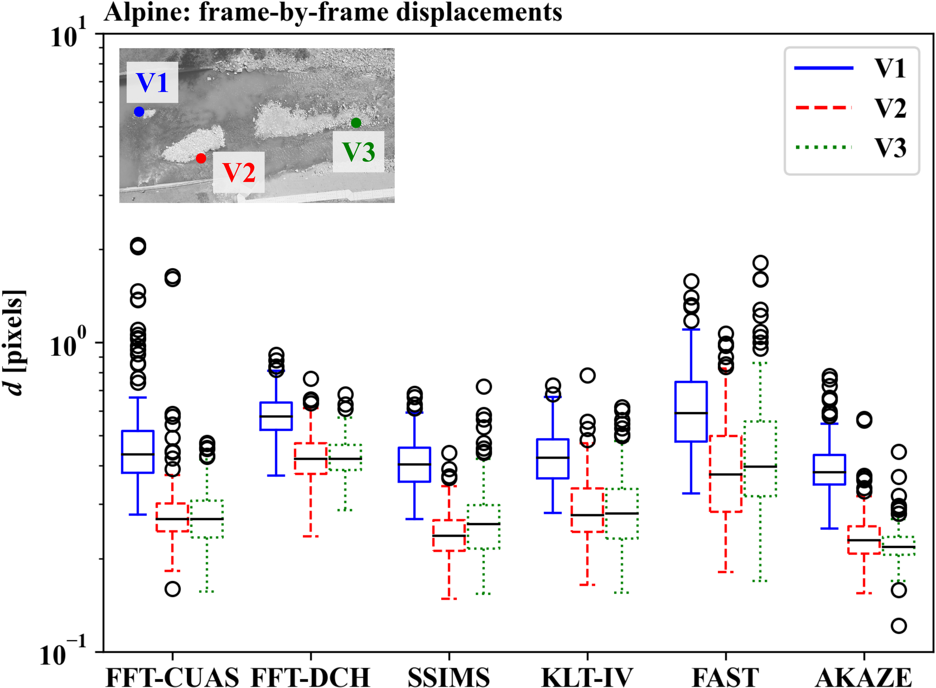
This research presents an investigation of different strategies and tools for digital image stabilisation for image velocimetry purposes. Basic aspects of image stabilisation and transformation are presented, and their applicability…
Information acquired from Unmanned Aerial Vehicles (UAVs) is frequently used nowadays in a variety of disciplines and research fields. The present study explores for the first time the combined use…
River monitoring is of particular interest as a society that faces increasingly complex water management issues. Emerging technologies have contributed to opening new avenues for improving our monitoring capabilities but…
River streamflow monitoring is currently facing a transformation due to the emerging of new innovative technologies. Fixed and mobile measuring systems are capable of quantifying surface flow velocities and discharges,…
Thermal inertia has been applied to map soil water content exploiting remote sensing data in the short and long wave regions of the electromagnetic spectrum. Over the last years, optical…
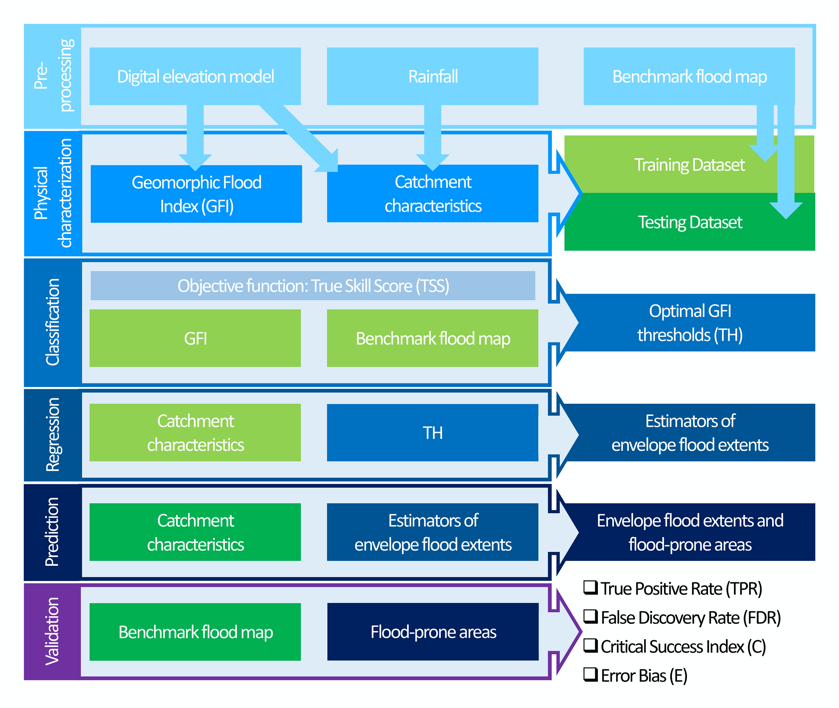
A topographic index (flood descriptor) that combines the scaling of bankfull depth with morphology was shown to describe the tendency of an area to be flooded. However, this approach depends…