Planning the future of Harmonious
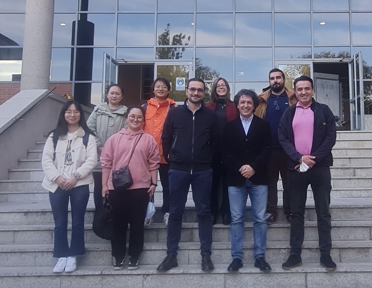
The Department of Topography and Cartography of the Technical University of Madrid hosted our work group meeting of COST Action – HARMONIOUS from 27 up to the 30 of October.…
Università degli Studi di Napoli Federico II - DICEA
The Department of Topography and Cartography of the Technical University of Madrid hosted our work group meeting of COST Action – HARMONIOUS from 27 up to the 30 of October.…
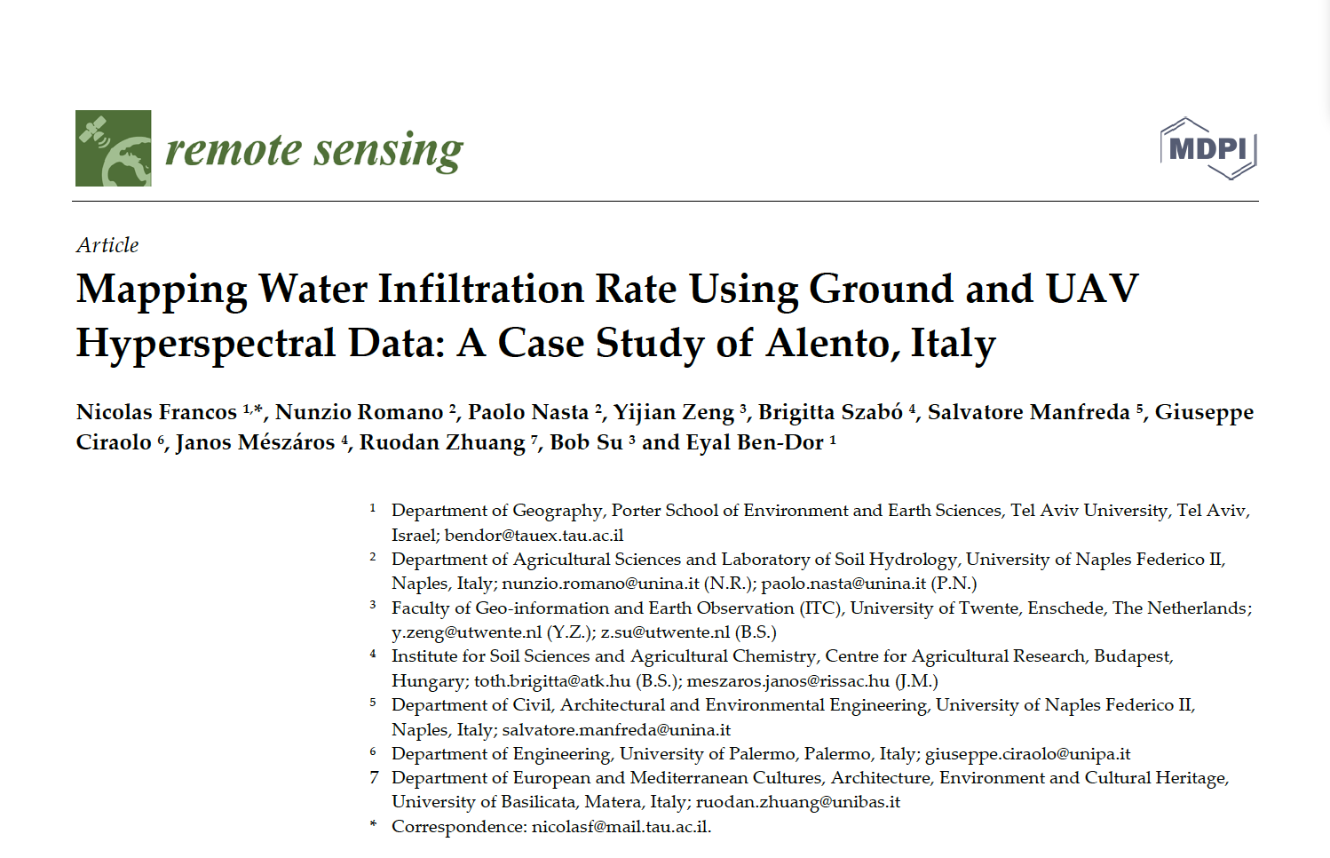
Water infiltration rate (WIR) into the soil profile was investigated through a comprehensive study harnessing spectral information of the soil surface. As soil spectroscopy provides invaluable information on soil attributes,…
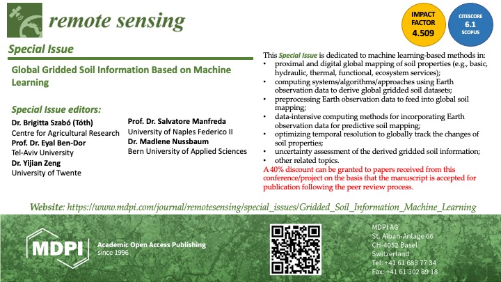
This Special Issue is dedicated to machine learning-based methods in:•proximal and digital global mapping of soil properties (e.g., basic, hydraulic, thermal, functional, ecosystem services);•computing systems/algorithms/approaches using Earth observation data to…
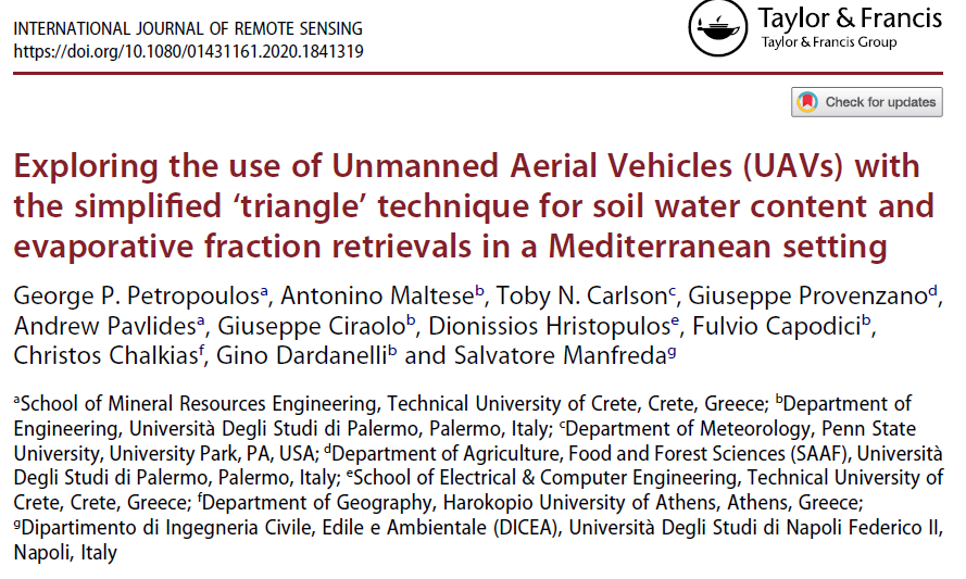
Information acquired from Unmanned Aerial Vehicles (UAVs) is frequently used nowadays in a variety of disciplines and research fields. The present study explores for the first time the combined use…
Thermal inertia has been applied to map soil water content exploiting remote sensing data in the short and long wave regions of the electromagnetic spectrum. Over the last years, optical…
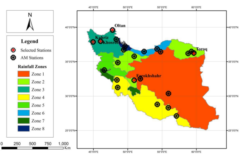
The past decades have seen rapid advancements in space-based monitoring of essential water cycle variables, providing products related to precipitation, evapotranspiration, and soil moisture, often at tens of kilometer scales.…
It is crucial to monitor the dynamics of soil moisture over the Tibetan Plateau, while considering its important role in understanding the land-atmosphere interactions and their influences on climate systems…
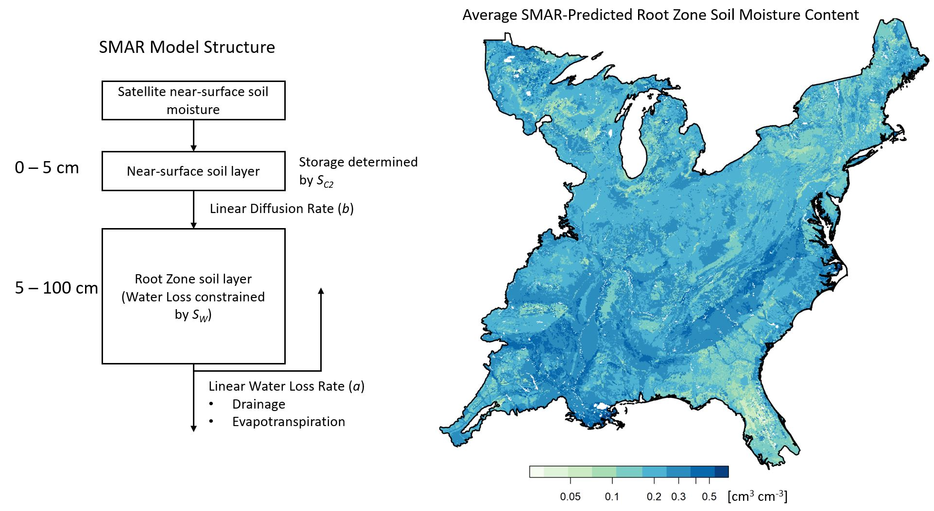
Root zone soil moisture (RZSM) affects many natural processes and is an important component of environmental modeling, but it is expensive and challenging to monitor for relatively small spatial extents.…
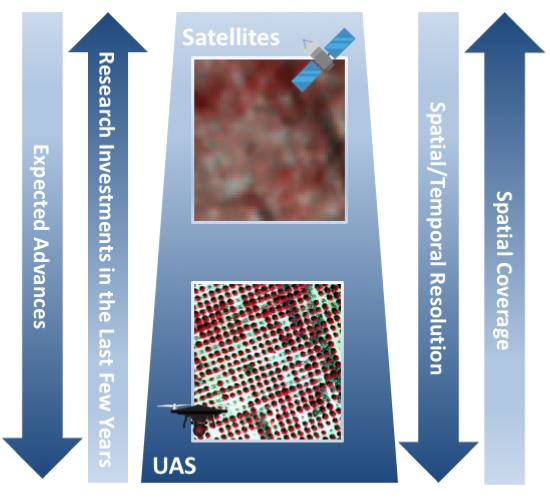
Environmental monitoring plays a central role in diagnosing climate and management impacts on natural and agricultural systems; enhancing the understanding of hydrological processes; optimizing the allocation and distribution of water…
Coordinatore locale del progetto intitolato “La mitigazione del rischio idraulico in bacini costieri con casse di espansione in linea: approccio di dimensionamento integrato” finanziato dal Ministero dell’Ambiente e della Tutela…
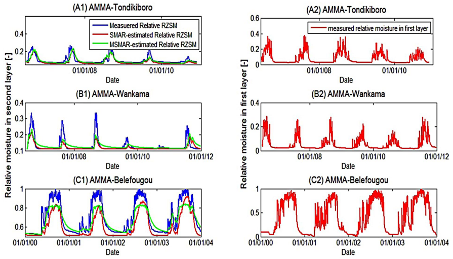
Monitoring Surface Soil Moisture (SSM) and Root Zone Soil Moisture (RZSM) dynamics at the regional scale is of fundamental importance to many hydrological and ecological studies. This need becomes even…
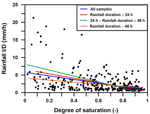
Rainfall-triggered shallow landslides have caused losses of human life and millions of euros in damage to property in all parts of the world. The need to prevent such phenomena combined…
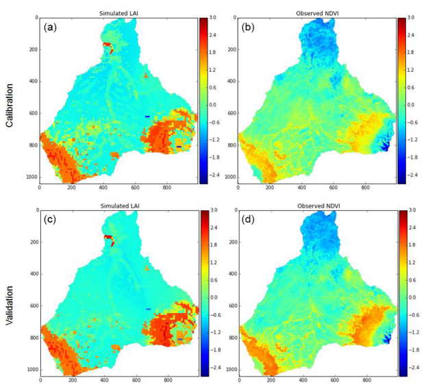
Ecohydrological modeling studies in developing countries, such as sub-Saharan Africa, often face the problem of extensive parametrical requirements and limited available data. Satellite remote sensing data may be able to…
Minimalist agro-hYdrological model for Sustainable IRRigation management – soil moisture and crop dynamics – MY SIRR v.3.0 is a software written in python programming language with a simple Graphical User…
Root-zone soil moisture at the regional scale has always been a missing element of the hydrological cycle. Knowing its value could be a great help in estimating evapotranspiration, erosion, runoff,…